Mattmaps
Sunday, April 24, 2011
Satellite Image & Topo Map of Great Lakes
Sattelite View of the Great Lakes Region
http://en.wikipedia.org/wiki/Great_Lakes
U.S. Power Grid Thematic Map
U.S. Power Grid & Power Stations
Crime Information Chart
Tampa Florida
http://www.tampagov.net/dept_Police/information_resources/Crime_Statistics/
Space Map
Solar System: The sun, planets and moons.
http://ibgames.com/fed2/maps/pix/solmap.gif
Lunar Landings and Labeled Moon Areas
Map of the moon and lunar landings
http://upload.wikimedia.org/wikipedia/commons/3/36/Moon_map_showing_apollo_missions.PNG
Zip Code Color Map
Zip Codes for Souther California
List of postal/zip codes for Los Santos.
Historical Mapping - Sherman March to the Sea
Sherman's Campaign in the Carolinas and Georgia During the Civil War
http://en.wikipedia.org/wiki/William_Tecumseh_Sherman
New York Theatre District Street Map
New York Broadway Theatre District
http://www.mustseenewyork.com/grid/broadway-map.html
The Nile River Basin -Topo Map
The Nile River Basin
http://images.search.yahoo.com/images
Photo - Landscape
Tropical Lanscape
http://images.search.yahoo.com/images/
The Welland Canal - Feature Map
The Welland Canal
http://en.wikipedia.org/wiki/Welland_Canal
The
Welland Canal
is a
ship canal
in
Canada
that extends 42 km (27.0 miles) from
Port Weller, Ontario
, on
Lake Ontario
, to
Port Colborne, Ontario
, on
Lake Erie
. As a part of the
St. Lawrence Seaway
, this canal enables ships to ascend and descend the
Niagara Escarpment
and to bypass the
Niagara Falls
.
Map of Native American Reservations
Native American Reservations
www,justice.gov
Topographical & Road Map
Grand Canyon
http://www.havasupaitribe.com/images/map-grand-canyon-national-park.jpg
Road Map
Upstate N.Y. Road Map
Curriculum Mapping
Geological Map -Mariana Trench
Mariana Trench
http://geology.com/press-release/deepest-part-of-the-ocean/
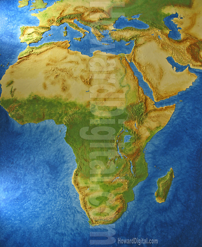
Contour Map - Africa
Africa Contour Map
http://www.howardmodels.com/0-topographic/landform-maps-models/africa/africa2.jpg
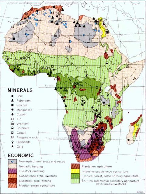
Economic Map
Africa
http://www.zonu.com/images/500X0/2010-01-12-11696/Africa-minerals-and-economic-activity.jpg
Political - World
http://ephotopix.com/image/world/world_political_map1.gif
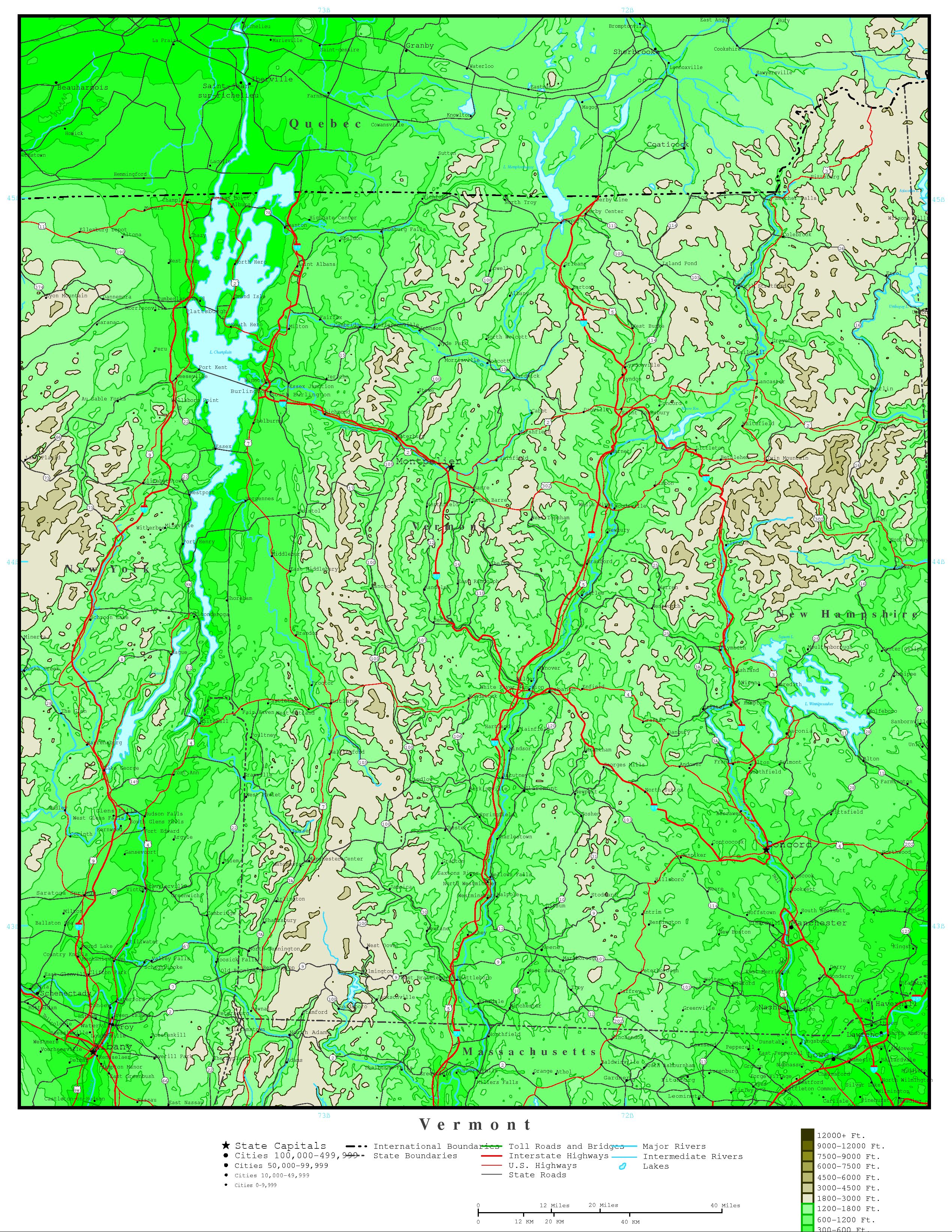
Contour Map
Vermont Elevation
http://www.yellowmaps.com/maps/img/US/elevation/Vermont-elevation-map-176.jpg
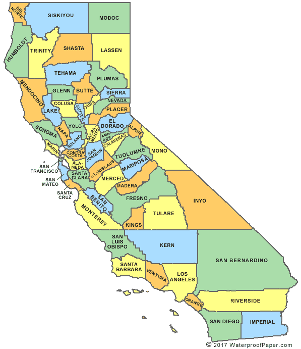
Topo Map
California Counties
http://www.digital-topo-maps.com/county-map/california.shtml
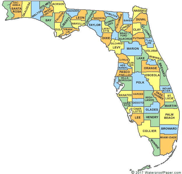
Topo Map
Florida Counties
http://www.digital-topo-maps.com/county-map/florida.shtml
Topograhical Map Europe
Europe
http://upload.wikimedia.org/wikipedia/commons/3/38/Europe_topography_map_en.png
Albania, topographic map
http://maps.grida.no/go/graphic/albania_topographic_map
Heat Dissipation Contour map
http://www.goldensoftware.com/products/grapher/grapher8-contourmaps.shtml
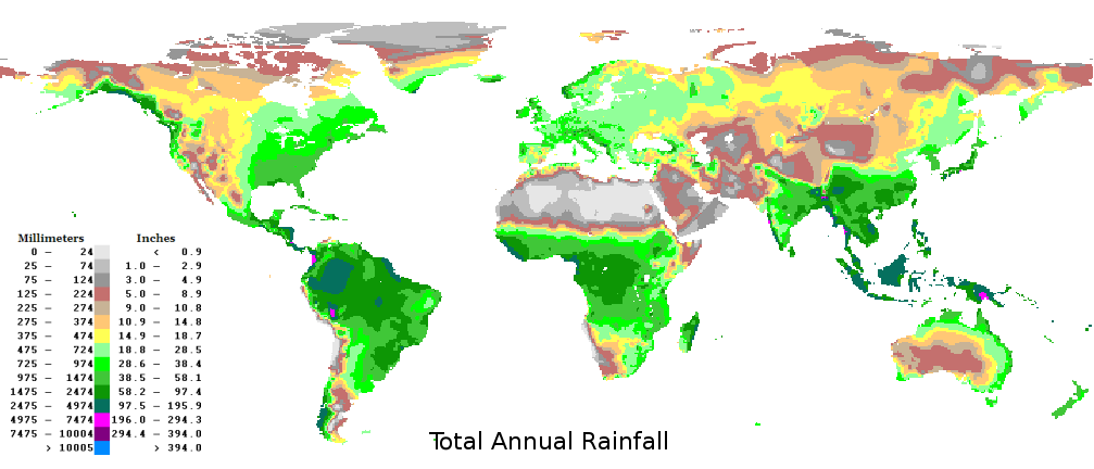
Mecklenbug Precipitation Contour map
http://nc.water.usgs.gov/char/contour/maps/20040717.html
Montreal road map
http://www.aaccessmaps.com/show/map/montreal_old
Floridian road trip with Florida road map
http://mapoftheunitedstates.wordpress.com/2008/09/23/florida-state-map/
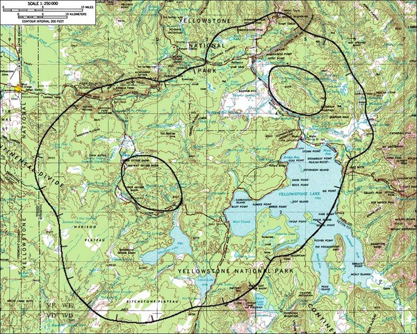
Yellowstone National Park Topographic
http://mappery.com/maps/Yellowstone-Lake-Topographic-Map.mediumthumb.jpg
Climate
Wind Speed
http://www.climate-charts.com/World-Climate-Maps.html#warming
This is annual average wind speed measured 50 meters above the ground or sea.
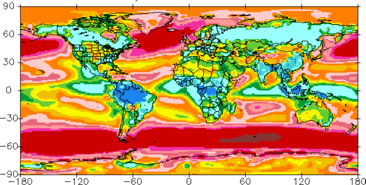
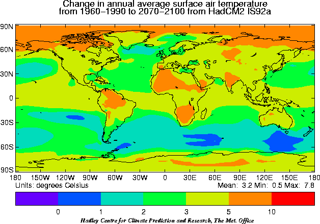
Climate Map
Climate Warming
http://www.climate-charts.com/World-Climate-Maps.html#warming
Climate Map
World Climate
http://www.climate-charts.com/World-Climate-Maps.html#warming
Thematic Cartogram
Gross Domestic Product
http://www-personal.umich.edu/~mejn/cartograms/
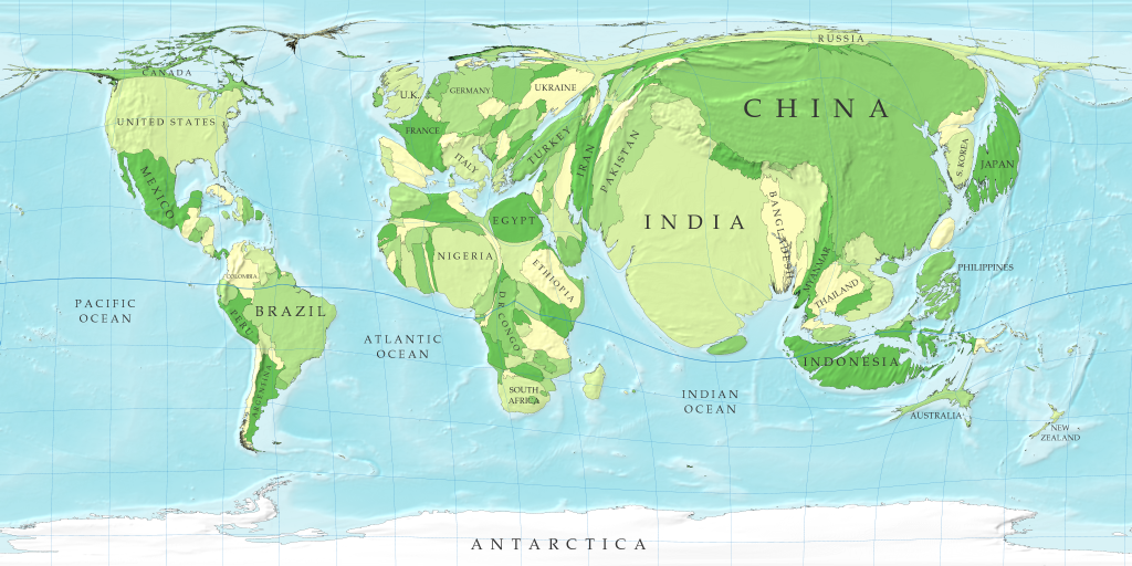
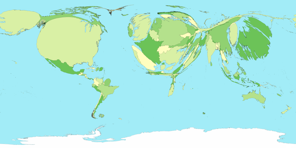
Thematic -
Population: Here the population is illustrated by the exaggerated size of the countries.
http://www-personal.umich.edu/~mejn/cartograms/
Geologic Map
Oil & Gas Investigation Maps & Charts
http://egsc.usgs.gov/isb/pubs/booklets/usgsmaps/usgsmaps.html#Oil
Thematic Map
Fertility Rates are represented by color and by the height of the raised values on the globe surface.
http://blog.thematicmapping.org/2008/03/first-thematic-map-examples.html
Thematic Map
Population Density of African Americans in U.S.
http://txsdc.utsa.edu/maps/thematic/
Space Mapping
Space Map
http://farm5.static.flickr.com/4116/4899531354_b025d768cc_z.jpg
Site Map For Web Page
Site Map for Webpage
http://www.xtreeme.com/sitexpert/samples/sample2/
Site map sample: Dynamically loaded tree
Go back to the samples list
about dmoz
AltaVista
Associations
Loading...
Authoring
Loading...
Bulgarian
Chinese Simplified
Commercial Graphic Design
Computers
Danish
Description
Loading...
Designers
Loading...
donaldb
Dutch
edseward
FAQ
Loading...
French
Google Directory - Computers > Internet > Web Design and Development
help
Hosting
Loading...
HotBot
http://dmoz.org/
Indonesian
Internet
Italian
kujanomiko
Lithuanian
Lycos
Message Boards
Loading...
Multimedia Developers
Norwegian
Polish
Portuguese
Promotion
Loading...
Redirects
Loading...
Romanian
Serbian
Spanish
Swedish
Terms of Use
Turkish
voll
Web Ring Systems
Loading...
Web Usability
Loading...
Web_Design_and_Development
Yahoo
Newer Posts
Older Posts
Home
Subscribe to:
Posts (Atom)


